Devastating flash floods have affected large parts of the small East African country of Djibouti, with damage to houses, schools and infrastructure.
Two years’ worth of rainfall fell in a single 24 hours in November, on top of several days of heavy downpours, and yet more rain is forecast.
Nine people are believed to have died, including seven children. Up to 250,000 people have been affected, mostly in Djibouti city, the country’s capital.
The Djibouti government is leading the relief operation with the support of the United Nations, humanitarian partners, civil society and armed forces stationed in the country.
Rotary-supported disaster mapping charity MapAction has sent two volunteers to assist the coordination of the response, at the request of the United Nations Disaster Assessment and Coordination team.
The MapAction team is providing reference and situational maps to help plan and coordinate relief activities.


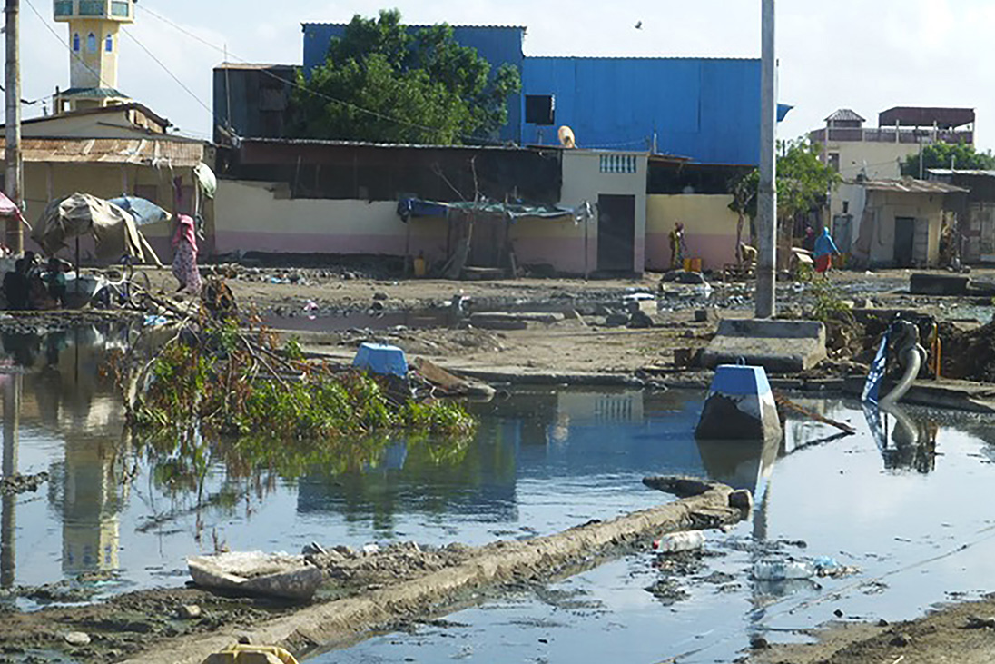
This image, taken three weeks after the worst period of flooding, clearly shows water levels still haven’t subsided and the impact is still very prevalent.
Humanitarian emergencies often strike without warning, destroying lives and livelihoods within a matter of seconds. In the immediate aftermath, the challenge for those responding is to know where to start.
MapAction, which is based at Chinnor in Oxfordshire, quickly gathers this crucial data at the disaster scene, conveying it visually in the form of maps.
Up to 250,000 people have been affected, mostly in Djibouti city, the country’s capital.”
By creating this ‘shared operational picture’ for aid agencies, governments and local partners, we can help them make informed decisions and deliver aid and emergency supplies to the right place, quickly.
Since 2003, MapAction has been applying expertise in geographical information and data to make humanitarian disaster response as effective as possible, saving many thousands of lives in the process.


