When disasters like earthquakes, hurricanes or floods strike, in order to save lives and reduce suffering, certain urgent questions need to be answered: which areas have been worst affected, where are the most vulnerable people, what has happened to roads, railways and communications networks, and what help is already being provided – where are the gaps?
The situation can be chaotic, confusing and, in some cases, dangerous. The challenge for responders is to work out what they need to do first.
Humanitarian mapping charity MapAction quickly gathers crucial data at the disaster scene and conveys it visually in the form of maps and charts.
Within hours of an alert, MapAction’s team of highly-skilled geographic information experts map the needs of those affected to help co-ordinate the response.
They piece together a ‘shared operational picture’ for aid agencies, charities, governments and local partners, helping them make informed decisions, co-ordinate relief efforts and deliver the right aid and emergency supplies to the right places, fast.
“Even in slower onset emergencies such as refugee crises, famines or epidemics like the 2014 Ebola outbreak in Sierra Leone and Liberia, understanding the geography of the situation is often the first crucial step to mounting an effective response. It helps to ensure that the right aid is pulled to the right place,” explained MapAction Trustee, Roy Wood, who is also a Rotarian.
I get to make a real impact in devastating situations using my expertise.”
“Humanitarian emergencies often strike vulnerable communities, in places where information about populations and infrastructure may be hard to get hold of or even non-existent.
“The first thing we do on hearing that we are needed is a data scramble, to find, check, sort and begin to visualise as much useful information about the affected region and the disaster as we can get from all reliable sources.
“That might be something as simple as an orientation map for aid workers arriving from other countries. MapAction personnel are often among the first humanitarian responders to arrive at the scene after a disaster and every minute counts.
“So, by the time they get on the plane, we want them to have as much useful information as possible to begin helping response teams.”
MapAction works through a small core team of around 15 staff, and over 80 highly skilled and trained volunteers, many of whom are ready to deploy at just a few hours’ notice to anywhere in the world.
“Our volunteer model enables MapAction to operate very cost-effectively, while having a powerful impact right at the heart of humanitarian responses,” explained current MapAction Chair of Trustees, Nigel Press.
“We can scale our efforts up and down as needed, without the overheads of large numbers of staff waiting around to be called to the next emergency.”
The charity works closely with national governments and regional and international aid agencies such as the United Nations, the International Federation of Red Cross and Red Crescent Societies and Save the Children.
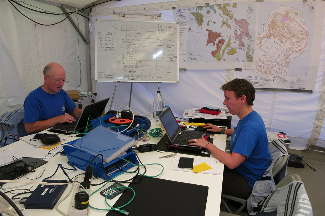

Members of the MapAction team respond to a disaster in The Philippines in 2013.
Its patron, Prince Harry, takes a hands-on approach in his support, participating in training exercises and face-to-face briefings on major emergencies such as the 2015 Nepal earthquake.
MapAction volunteers are drawn from a wide a variety of fields and professions, from Antarctic surveying to meteorology and zoological research.
They join the charity with a solid understanding of geographical information systems, databases and information management, and undergo a rigorous and ongoing training programme covering all the skills they need to work in the highly demanding and specialised environment of a humanitarian emergency.
“MapAction gives me a real balance in life; the people I meet and experiences I have are a constant reminder of how lucky I am,” reflected volunteer Kirsty Ferris, a Subsea Equipment Rentals Manager.
She has been deployed numerous times to disasters such as the Ebola outbreak, three Caribbean hurricanes, Typhoon Haiyan in the Philippines, the Nepal earthquake, the Syrian refugee crisis and floods in Ghana, Mexico and Albania.
Even in slower onset emergencies such as refugee crises, famines or epidemics… understanding the geography of the situation is often the first crucial step to mounting an effective response.”
“I get to make a real impact in devastating situations using my expertise in GIS, information management and mapping.”
In between deployments and team training, volunteers prepare government authorities and responders around the world to plan and prepare for disasters, sharing their humanitarian mapping and information management knowledge as well as providing remote mapping support as needed.
Several Rotary groups have supported MapAction’s work in recent years, and the need for its services is greater than ever.
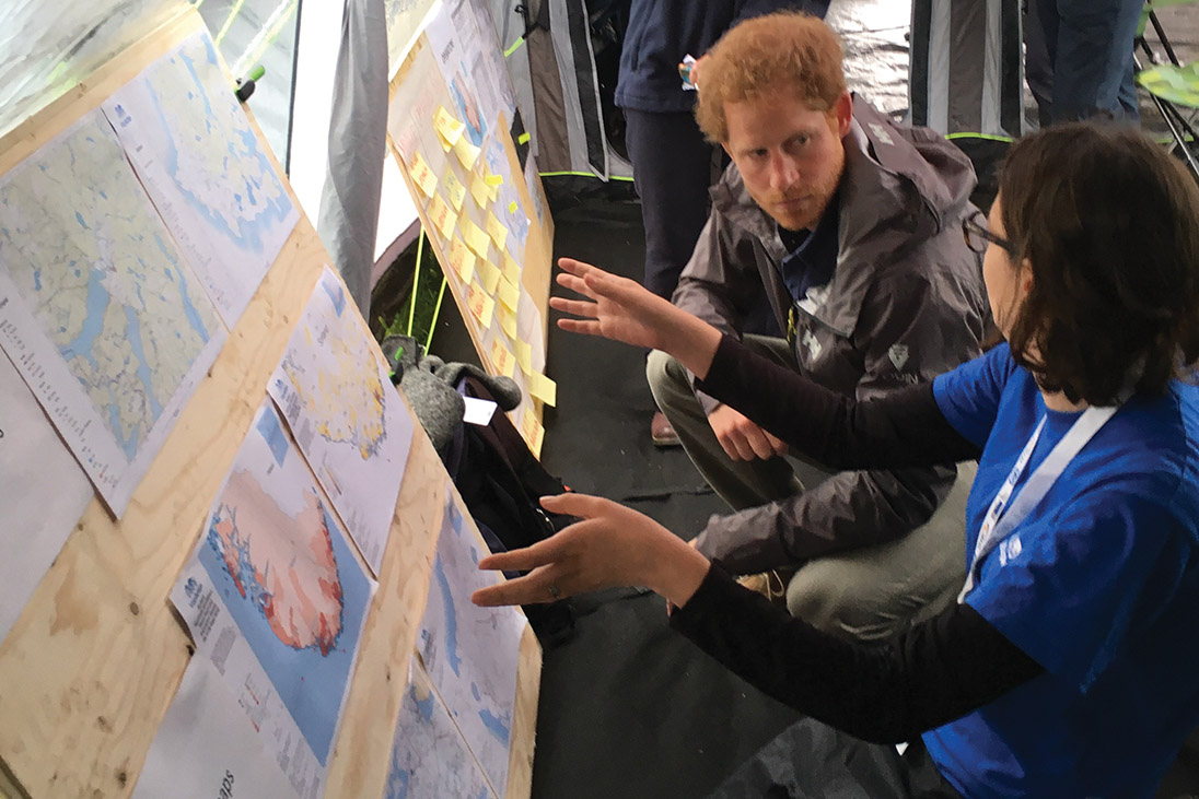

Prince Harry, MapAction’s Patron, working closely alongside Rachel Alsop
The United Nations Office for the Coordination of Humanitarian Affairs estimates that in 2018 there will be 128 million people needing urgent, life-saving assistance around the world.
Last year’s Caribbean hurricane season was one of MapAction’s most intensive and extensive periods of operation to date, with teams mobilised across the region – while conflict in different parts of the world is causing large-scale displacement of entire populations, often putting people in very dangerous and vulnerable situations.
MapAction has sent expert mappers to almost 80 humanitarian emergencies since it began operations in 2002 and supported many more responses remotely.
Next time you hear about an emerging humanitarian disaster anywhere in the world, there’s a good chance that MapAction mappers are already pulling together all the available data and using it to make life-saving maps that help create a clear picture out of the chaos.

